Both Monday and Tuesday were overcast, grey, cold and mostly lounging about days, as we recovered from the weekend. Fi went into central Dunedin on Monday and photographed about 70 buildings south and west of the Octagon, following up on the architecture tour of the previous week with City Walks Dunedin. People not interested in buildings should escape quickly to the next paragraph. Here are some of Fi's photos:
 | |||||||||||||
| Fortune Theatre (Gothic revival style 1870), basalt and Oamaru limestone, | southernmost theatre in world |
 |
| Bank of New Zealand 1883, wonderfully ornate exterior |
 |
| empty, unloved and with the cost of building to the new earthquake code, possibly unrestorable |
 |
| the ambulance HQ, great art deco beautifully restored |
On Wednesday, we decided to set out on an expedition to see the scenery in an area of the South Island we didn't visit in our Xmas 2008 trip - the Central Otago Highlands and the Maniototo Plain.
We left about eight in the morning - grey and overcast - and drove out through the western suburb of Mosgiel to start our long climb to the head of the isolated Taieri River valley (Taieri is Maori for "shining river"). Remnants of snow were glimpsed on the peaks of the surrounding ranges through the cloud to our left and right as we wound our way up the narrow twisty State Highway 87 toward Middlemarch.... with the all too familiar view dead ahead.....the Fonterra milk double-tanker:
 |
| not often enough for us! |
We stopped at the Kissing Gate Cafe in Middlemarch for a cup of coffee and popped into the Post Office to pass on a greeting to the postmistress from Mark, one of the many friends we have made at Pirates.

Further up the road, we went for a short walk at the Hyde Memorial, a cairn to the 21 people who were killed in a derailment of a steam engine and seven carriages of the Cromwell to Dunedin train on 4 June 1943. The train was allegedly travelling at 120 kmph in a cutting designed for speeds of half that.
We met three blokes on mountain bikes doing the "Rail Trail".
It was very difficult to photograph the scenery on this trip as the panoramas were huge and the lens flattens the perspective and dulls the colours, particularly the lush Irish greens of the grassier areas. But here is a photo of the area around Hyde, generally representative of the barren-looking but gloriously wild landscape, lots of yellow gorse, rock-strewn, tree-less, layers and layers of mountain ranges cascading into the background, not a place to be lost without water at any time of year:
 |
| For all that it looks like Donegal, this is wildness and wilderness on a much grander scale |
We headed up the valley past the Rock and Pillar Range (1400 m) in search of more scenery. As we went north towards Kyeburn, the cloud lifted and soon we were in clear blue skies and blazing sunshine. The temperature was approaching a staggering 19 degrees! The scenery changed as we left the rocky wilderness of Otago schists and progressed into the alluvial valleys and flat grass plains of the Maniototo which are partly ringed to the north and east by the icing-sugar dusted Kakanui and Hawkdun mountain ranges (that icing sugar bit is my poetry for snow capped).
There is a huge history of gold mining in the Central Otago region, almost all alluvial. The gold found here from 1863 onwards powered the growth of Dunedin and small townships all over the Central Otago Highlands in the late 19th century. We stopped off at several of the small townships north and west of Kyeburn, nearly all of which boast lovely old buildings (usually character pubs, stone houses and double storey post offices) dating from the 1870s onwards.
Apart from the huge gold rush in this region in 1863, the other factor which made a big impact on its development was the arrival of the railway. The old Central Otago railway ran from Clyde and Alexandra in the northwest over to Ranfurly and then south to Middlemarch. The line was started in the 1890s and decommissioned in 1990. Rather than see the railway reserve absorbed into local farmland, the Department of Conservation in Otago succeeded in getting support to turn the abandoned line into a walking and cycling track - the 150 km long The Otago Central Rail Trail. The lack of steep grades make this suitable for all ages and with plenty of accommodation and other service providers in small towns en route, thousands of visitors flock to the track every year. The track was visible from or close to many of the places we visited in our two days away.
We visited the old gold mining township of Naseby (site of a big indoor curling rink) in the hopes of finding lunch, but unfortunately Naseby was closed!
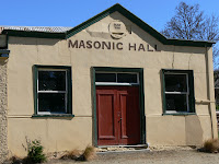
Here are some photos of the centres of power in Naseby in the old days. Left to right: the Masonic Hall built in 1869, the County Offices built in 1878 and the Post Office built in 1900.
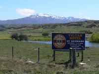
Ranfurly then became the designated lunch destination, but the meals at the art deco-style Ranfurly Hotel were mediocre at best. We then set off in search of more gold mining history. Our initial plan was to stay overnight at the historic Vulcan Hotel at St Bathan's and spend the rest of the afternoon checking out the area between St Bathans and Alexandra. So at two o'clock we rolled down into St Bathans village through some lovely scenery and parked outside the pub. Here are some of the 176 photos that Fi took:
 |
| Sign at turnoff from SH85 |
 |
| Main street, St Bathans. Vulcan Hotel at bottom of hill |
 |
| Vulcan Hotel St Bathans - Ireland and All Black flags and an all black dog playing ball |
Some 100,000 ozs of gold was mined from this district and in the mid-1860s there were 2000 people, 13 pubs, 2 banks, a police station and a jail in this area. Many of the miners were Irish (see the shamrock above the door of the Vulcan Hotel in the photo above), in contrast with the dominantly Welsh miners in the neighbouring settlement of Cambrians some 5 km away.
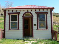
The photo on the far right below is the Bank of NSW building (1864) in St Bathans (which was also the Gold Office). The photo on the far left is of the 1879 stone school house. The wooden house in the middle photo is called Rowan Cottage and was owned by builder Thomas Wilkinson.
 |
We investigated the accommodation at the Vulcan and were told we could have Bedroom 1 with its friendly ghost and shared facilities next to the bar for $65 per person which seemed a big ask for us so we decided to push on to Cambrians and Becks and decide about a bed later.
We carried on to Cambrians, driving through the settlement to a lookout point with a view over the Cambrian station homestead (follow the sign that says "here"), which sits in a fabulously green valley surrounded by majestic snow-capped mountains, very Swiss, but not. The humour of the Welsh was evident in the roadside signposts and boxes:
 |
| Cambrians scenery |
We then went looking for a settlement called Drybread but blinked and missed it. It would have been good to have more time to explore this area. But we decided to head to Alexandra ("Alex") for the evening and after stopping for a coffee at the excellent Muddy Creek Cafe in Omakau, we arrived at the I-Site in Alex at four o'clock. Accommodation was arranged for us at the Last Chance Lodge and we checked out the local art show and then spied this across the road:
 |
| Monteith's Brewery Bar |
After a small, quick Montieth's Black, we drove out to the Lodge, unpacked our gear and went for a walk on a trail following the Clutha River through the Earnscleugh Tailings. A brisk one hour walk took us from leafy streams to the barren landscape you associate with tailings. The tailings are being reclaimed naturally, with cypress and poplar trees springing up, and an extensive covering of wild thyme, which magically scents the air as you walk past.
 |
| Thyme-covered Earnscleugh Tailings and Dunstan Mountains |
For those of mining and geology bent, Alexandra was the gold-dredging capital of the world. As mentioned before, almost all the gold in this region comes from alluvial deposits (the source is small veins in the Otago Schist that comprises most of the mountain range. These veins have proved uneconomic to locate and work even at today's gold price). Hence the technology and methods of dredging were developed here and exported all over the world. Go see the fabulous museum in the Alex I-site if you want more detail!
Alexandra is a good size town with some lovely scenery, the aforementioned mining history and, as always, where you find gold mines, you find wineries.
Following a great meal and some nice wines at the Red Brick Restaurant in central Alexandra, we headed to our modest palace to crash for the night.
Day two dawned sunny, but with that early chill of minus four always associated with mountain valleys. We packed up and jumped into the car and headed into Alexandra for breakfast. There we discovered the Tin Goose Cafe - in the must visit category if you are ever in town:
 |
| Tin Goose Cafe |
Fi wanted to do some walking after breakfast and she headed off to the Shaky Bridge and the pioneers cemetery, while I was interested in sampling the wines of the Three Miners vineyard. They produce four varieties - a Riesling, a Gewurztraminer, a Pinot Gris, and a Pinot Noir. I had had the Pinot Gris at the restaurant the previous night (a perfect accompaniment to the mushroom and walnut soup) and, not having the sweetest tooth, skipped on sampling the Gewurztraminer, but both the Riesling and the Pinot were excellent.
Sampling and chatting used up the allotted hour, so I dashed back to town to rendezvous with Fi at the Tin Goose. Remembering our disappointing lunch yesterday, we raided their shelves for smoked salmon rolls for lunch and headed off to capture some more scenery. We went via a slightly different route this time and went back up State Highway 85 but turned off towards Ophir and went over the Daniel O'Connell bridge (pictured below). We had a quick look at the Poolburn pub (with a quick side trip towards the Poolburn reservoir) and then drove through the wonderfully green Ida Valley to Kyeburn. Then we headed through Morrisons (had to, hey) on SH85 and back to Dunedin via Palmerston. We got home about 7 pm, unpacked and had an early night, completely blown away by the amazing scenery of the previous two days. So, so glad we went and had a look, no matter how cursory.
 |
| Daniel O'Connell bridge, opened 10 May 1880 |

In hindsight, if we were doing another reconnaissance of this area, we'd plan for at least four days away. The trip would include an overnight stay at Cambrian station and an overnight stay at the Danseys Pass Inn. We'd also stay at the Moa Creek pub in the Ida Valley and take a four wheel drive with us to drive into the back country above the Poolburn Reservoir to emerge at a place called Stone Henge on the west side of the Rock and Pillar Range. If you like remote, this would be one of the remotest and most beautiful drives on the planet.
 |
| Poolburn area scenery |
You can find more info about Central Otago here.
Today is Friday and it was a washing and blogging day, taking time to prepare for the weekend, for yes, the RUGBY returns! It is quarter finals weekend and we are flying from Dunedin to Auckland in the morning for two matches - England v France on Saturday night and New Zealand v Argentina on Sunday night. So far we have been all too successful at avoiding seeing the Wallabies live because of the way the RWC draw was organised. We'll be back on Monday night, so no more blog until Tuesday or Wednesday (12th) of next week.


No comments:
Post a Comment